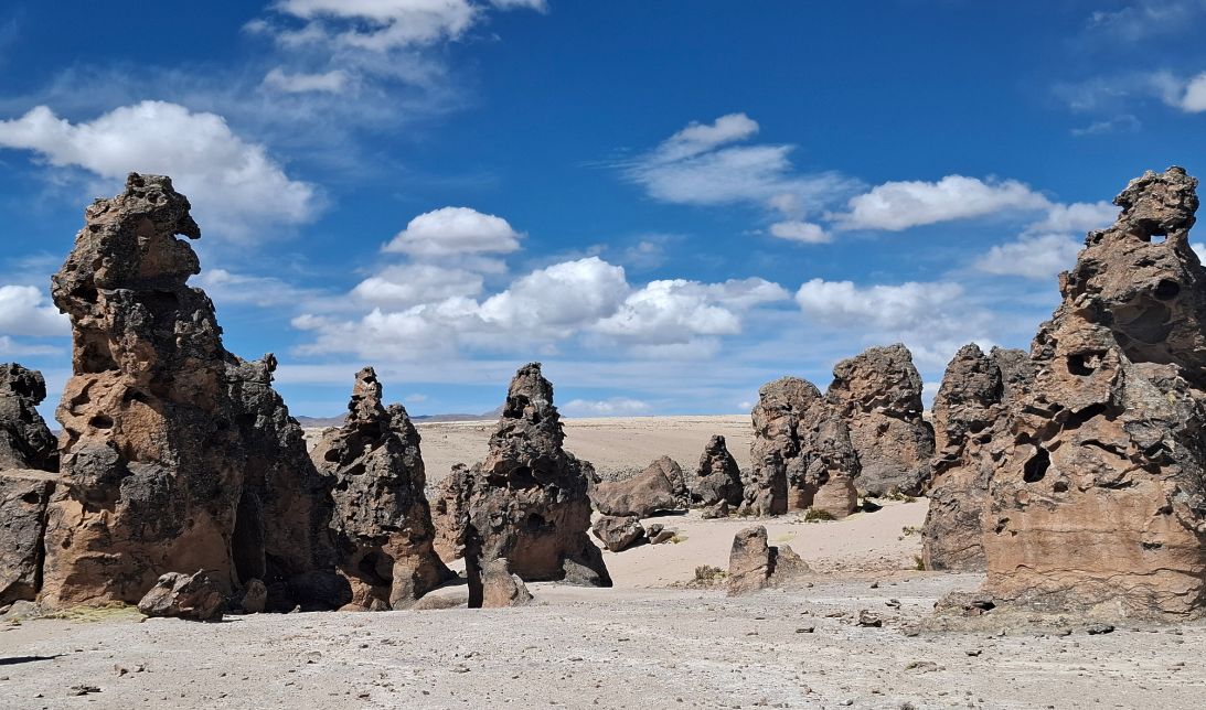
The Imata Stone Forest in Arequipa is a field of ignimbrite columns up to 15 m tall, sculpted by volcanic eruptions 15 million years ago at 4,200 m.a.s.l. in the Caylloma puna.
The Imata Stone Forest stands as one of the most otherworldly landscapes in southern Peru — a field of volcanic rock columns rising up to fifteen meters above the Andean plateau, carved by millions of years of geological forces into shapes that resemble animals, faces, and abstract sculptures. Located at 4,200 meters above sea level in the San Antonio de Chuca district, Caylloma Province, Arequipa Region, the Imata Stone Forest is neither a human creation nor an archaeological site; it is the direct product of one of Earth’s most powerful processes: catastrophic volcanic eruptions, tectonic uplift, and the relentless erosion of the high-altitude puna.
The site covers approximately eight hectares of columnar ignimbrite formations, each one unique in height, color, and shape. The columns display a palette of earthy tones — grays, browns, yellows, deep reds, and chalky whites — that shift dramatically with the angle of the sun. At sunrise, the stone glows warm ochre; by midday, the high-altitude light bleaches it silver; in the late afternoon, raking shadows turn every crack and protrusion into a topographic map in miniature. The silence of the puna surrounds everything, broken only by the wind and, occasionally, the sharp whistle of a viscacha peering down from the rocks above.
History of the Imata Stone Forest
The geological history of the Imata Stone Forest begins roughly 15 million years ago, long before the Inca civilization rose in the Andes. At that time, the southern Andean chain was the site of catastrophic volcanic eruptions that expelled colossal volumes of pyroclastic material — clouds of ash, lapilli fragments, and rock blocks that swept across the landscape at tremendous speed. As these flows came to rest and began to cool, something critical happened: the finer ash particles did not simply settle and harden separately. Still hot enough to partially fuse together, they compacted into a dense, stratified rock known as ignimbrite — a word derived from the Latin for “fire cloud,” fitting for a material born in such violent circumstances.
For millions of years, these thick ignimbrite layers were buried beneath subsequent deposits. Then, as the Andean tectonic uplift — the slow, unstoppable process that has been building South America’s mountain spine for tens of millions of years — pushed the plateau higher and higher, these volcanic layers were eventually exposed to the elements at extreme elevation. What followed was differential erosion: the softer zones in the rock were attacked by seasonal rains seeping into microscopic cracks, by the overnight freezing of trapped water at temperatures that can plunge below -4°C, and by the constant abrasion of the wind carrying fine dust across the open pampa. The harder, more resistant portions of the ignimbrite survived this assault — and those survivors are the columns the visitor sees today.
The resulting landscape was registered as a tourist resource by the Peruvian Ministry of Foreign Trade and Tourism (MINCETUR) under the category of natural rock formations. The private land on which the forest stands has been in the hands of the Pumacota family since 1967, acquired through possessory inheritance, and today the site is described as being in excellent natural condition. Though modest in infrastructure — there are no visitor centers or marked trails — the place makes a lasting impression precisely because of its raw, unmediated contact with geological time.
A Living Puna Ecosystem at Over 4,200 Meters
Visiting the Imata Stone Forest means immersing yourself in one of South America’s most demanding ecosystems: the high-altitude puna. At over 4,200 meters above sea level, the air carries roughly 40 percent less oxygen than at sea level, temperatures can swing from 15°C at noon to well below freezing after dark, and ultraviolet radiation is far more intense than at lower elevations. Yet life has adapted to these extremes in remarkable and often beautiful ways.
The vegetation around the stone columns is dominated by ichu (Stipa ichu), the wiry bunchgrass that covers the Andean plateau in a tawny, wind-swept carpet. Growing between columns and on rocky ledges, yareta (Azorella compacta) forms dense cushion-like mounds of tightly packed foliage that can live for thousands of years, each year adding only a fraction of a centimeter. The tola shrub (Parastrephia lepidophylla), with its small resinous leaves and woody stems, fills the air with a faint herbal scent on warmer afternoons and has long been used by local communities as fuel and in traditional medicinal preparations. Where moisture accumulates near watercourses, the puna gives way to bofedales — high-altitude wetlands carpeted in vivid green that offer a striking contrast to the surrounding ochre and brown.
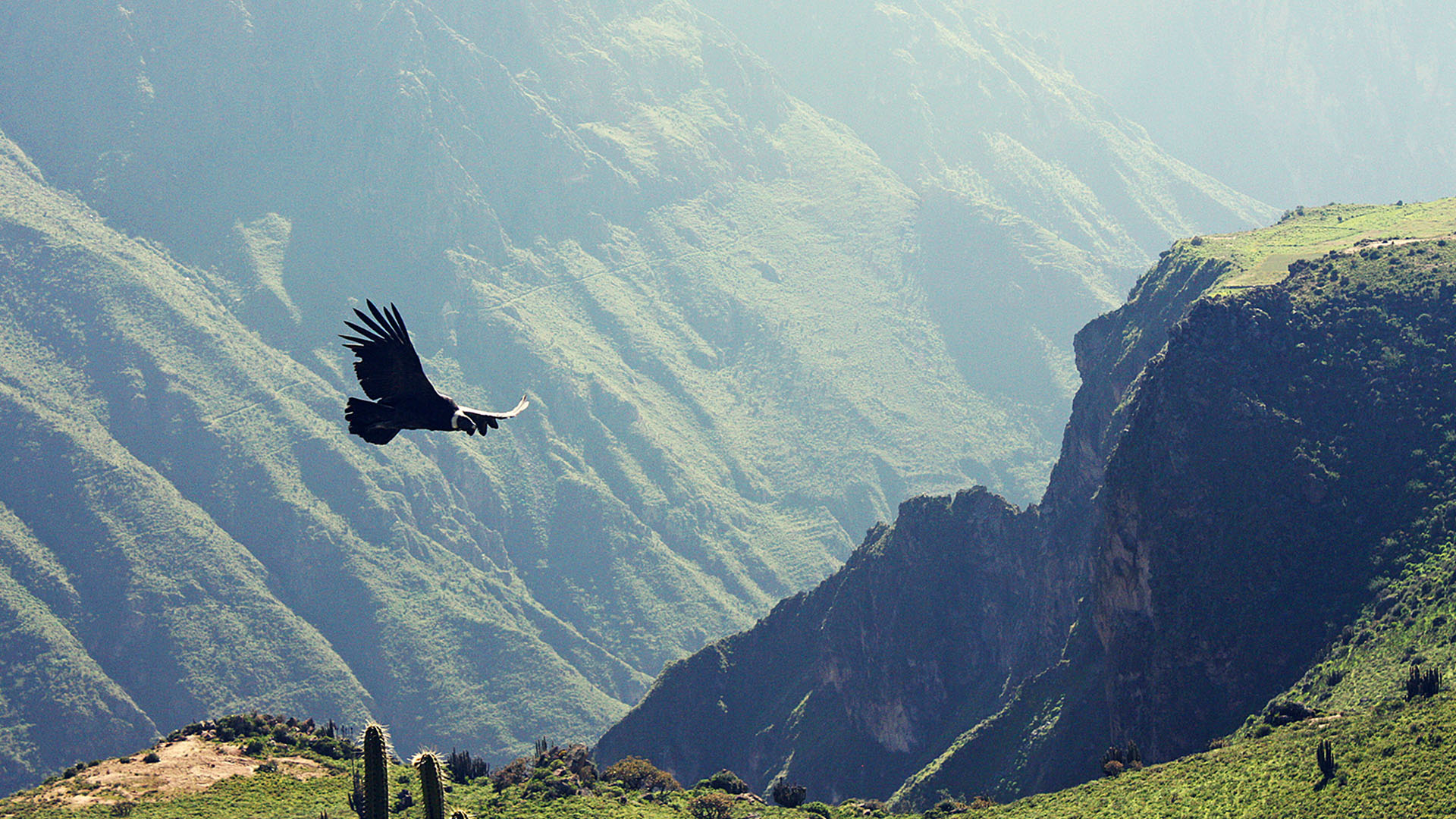
The fauna is equally characteristic of this altitude zone. Viscachas (Lagidium peruanum) — rabbit-like rodents with long ears and bushy tails — have colonized the crevices between the stone columns and are the animals visitors most reliably encounter. They are remarkably unafraid of humans, often sitting in full view on sun-warmed rock ledges and watching visitors approach with an air of calm indifference. The Andean fox (Lycalopex culpaeus) hunts the surrounding pampa, most visible at dawn and dusk when it moves along the edges of the formation field. On clear days, the broad wingspan of the Andean condor (Vultur gryphus) can be spotted riding thermal currents that bounce off the warm rock surfaces. Andean geese (Chloephaga melanoptera) pass in formation overhead, and patient birdwatchers may also spot carunculated caracaras, mountain hawks, and the elusive Andean tinamou.
Highlights of the Imata Stone Forest
The Central Column Field — The densest cluster of formations occupies the heart of the site. Here the tallest columns — some reaching twelve to fifteen meters — create a labyrinthine space where every step reveals a new perspective. Morning light, hitting the columns at a low angle, accentuates every texture and shadow, making this the most rewarding time to explore this section.
The Natural Viewpoint — At the upper edge of the formation field, a natural rocky promontory offers a sweeping panoramic view across the entire stone forest with the open puna stretching toward the horizon. This is the preferred spot for wide-angle landscape photography and for drone flights when wind conditions allow.
The Anthropomorphic Figures — A cluster of columns in the northern section of the site has been informally named “the giants” by local residents. Observed from a specific angle, their silhouettes suggest standing human figures of great height gazing toward the Andean horizon — an optical effect that becomes particularly striking at dusk when fading light softens the rock’s surface and elongates its shadows.
The Surrounding Pampa — Beyond the column field, the open puna provides excellent wildlife viewing opportunities. Early-morning walks along the perimeter regularly reward visitors with viscacha sightings, occasional fox encounters, and condor overflights.
Pillones Waterfall (Nearby) — While technically a separate attraction, the Pillones Waterfall is located close enough to Imata that most organized tours combine both in a single day. The contrast between the stone forest’s dry volcanic austerity and the lush, thundering cascade at Pillones makes for a geologically and visually rich excursion.
Tips for Visiting the Imata Stone Forest
- Best season: April through October brings clear skies and dry access roads. The wet season (November to March) can cloud over the formations and turn the unpaved track from Imata into a muddy obstacle without a four-wheel-drive vehicle.
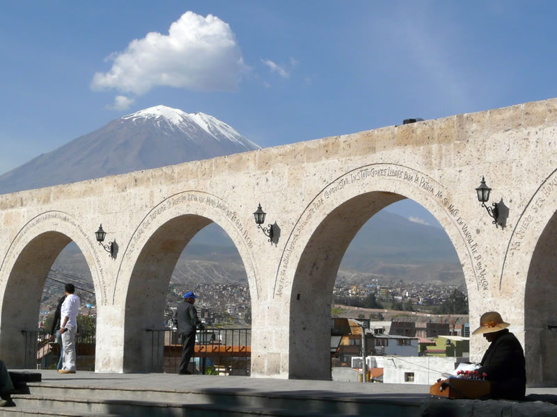
- Acclimatization is essential: At 4,200 meters above sea level, altitude sickness can affect even experienced mountain travelers. Spend at least one night in Arequipa (2,335 m.a.s.l.) before the visit, drink at least 2 liters of water on the day of travel, avoid alcohol the night before, and carry altitude sickness medication or coca leaves as a precaution.
- Dress in layers: The temperature swing between noon and late afternoon can exceed 15°C. Bring a windproof and waterproof outer layer, gloves, and a warm hat regardless of how mild the morning feels. Wind at this elevation makes the effective temperature feel significantly colder.
- Footwear: The terrain is rocky and uneven. Ankle-supporting hiking boots with a non-slip sole are essential. Lightweight sneakers or sandals are not appropriate for this site.
- Photography timing: The best light falls in the two hours after sunrise, when warm tones and diagonal shadows bring the column textures to life. A polarizing filter saturates the ignimbrite’s colors and cuts glare from the sky. Note the site closes at 3:00 p.m., so a midday start from Arequipa is feasible but leaves little room for photography at ideal light.
- Sun protection: UV radiation at 4,200 meters is intense even on overcast days. Apply high-SPF sunscreen, wear a wide-brim hat and sunglasses, and bring lip balm with UV protection.
- Respect the property: The site is privately owned by the Pumacota family. Do not climb the columns, do not remove stone fragments, and carry out all waste. The puna ecosystem at this altitude regenerates extremely slowly — every disturbance takes decades to heal.
How to Get to the Imata Stone Forest
Lima – Arequipa
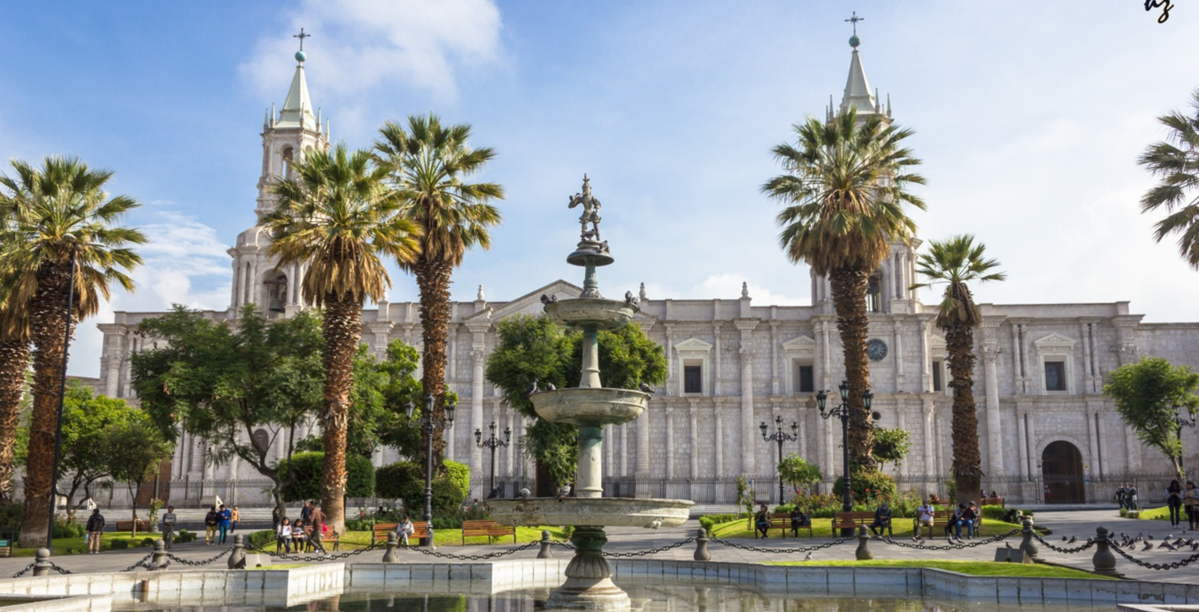
The most practical first leg is a direct flight from Lima’s Jorge Chávez International Airport to Arequipa’s Alfredo Rodríguez Ballón International Airport — roughly 1 hour 20 minutes in the air, with several daily departures from multiple airlines. Budget travelers can opt for an overnight bus from Lima: multiple carriers offer semi-cama and fully reclining cama seats on the 1,009-kilometer route, arriving in approximately 14 to 16 hours at ticket prices ranging from S/ 80 to S/ 180 depending on class and company.
Arequipa – Imata
From Arequipa’s main bus terminal, buses bound for Juliaca or Puno depart regularly and pass through the town of Imata at kilometer 165 of the Panamericana Sur highway. Tickets cost between S/ 15 and S/ 20 plus a S/ 1.50 regional boarding fee, and the 164-kilometer journey takes between 2.5 and 3 hours. Travelers driving a private vehicle follow Route 34S northeastward out of Arequipa; the road is fully paved all the way to Imata.
Imata – Stone Forest
The 13 kilometers of unpaved track between the town of Imata and the stone forest take roughly 25 minutes by vehicle. There is no regular public transport on this stretch. Options include hiring a local vehicle or motorcycle taxi in Imata, arriving as part of an organized tour from Arequipa, or driving a private car with adequate ground clearance. Organized tours combining the Stone Forest with the Pillones Waterfall are widely available from Arequipa tour operators and typically range from S/ 75 to S/ 100 per person with transport included.
Frequently Asked Questions about the Imata Stone Forest
How much time do you need to visit the Imata Stone Forest?
A relaxed visit of 1.5 to 2 hours is sufficient to walk through the column field, observe wildlife, and take photographs. Those combining the stop with the nearby Pillones Waterfall should plan for a full-day excursion from Arequipa — roughly 8 to 9 hours round trip including both sites and all travel time.
Can you visit the Imata Stone Forest year-round?
Yes, the site is open throughout the year, but the dry season from April to October is strongly recommended. During the wet months (November to March), overcast skies reduce the visual impact of the formations, and the 13-kilometer unpaved track from Imata can become impassable without four-wheel drive.
How much does entry to the Imata Stone Forest cost?
Admission is free. However, reaching the site from Imata requires either a private vehicle, a locally hired taxi, or an organized tour from Arequipa. Some visitors coordinate directly with the Pumacota family, who own the land, and a small voluntary contribution for site maintenance may be requested.
How difficult is it to reach the Imata Stone Forest?
The logistical challenge is greater than the physical one. The 13 kilometers of unpaved track between Imata and the forest require a vehicle with good ground clearance — ideally four-wheel drive during the wet season. Once on site, the walk through the columns is gentle with no significant elevation changes, although the altitude of 4,200 meters above sea level can cause fatigue and breathlessness in visitors who are not acclimatized. Moving slowly and drinking plenty of water makes a significant difference.
Are there tourist services near the Imata Stone Forest?
The town of Imata, 13 kilometers away, offers basic accommodation, small restaurants, a fuel station, and a POLTUR (Tourist Police) post. Infrastructure is modest, and most visitors prefer to base themselves in Arequipa — which offers a full range of hotels, restaurants, and tour operators — and use the stone forest as a day trip destination.
Opening Hours
- 6:00 – 15:00
- Approximate
Entrance Fee
- Free admission
- Approximate