The Valley of the Volcanoes, in Andagua, Arequipa, features 32 volcanic cones and an underground river. Peru's first UNESCO Global Geopark.
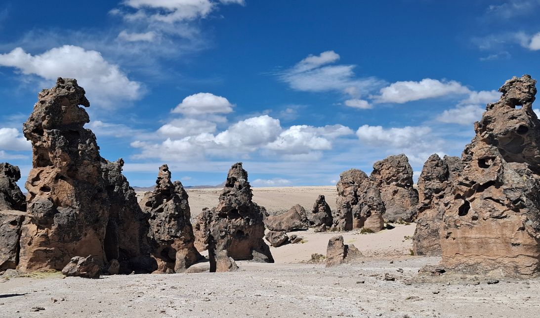
There are landscapes in Peru that resemble nowhere else on Earth. The Valley of the Volcanoes, located in the district of Andagua, province of Castilla, in the Arequipa region, is one of them. At 3,600 meters above sea level, this inter-Andean valley holds 32 perfectly identified volcanic cones that rise from the ground like dark, silent structures frozen in time after thousands of years of geological activity. The most imposing of them, Pucamauras, rises 350 meters above the valley floor; the smallest barely exceeds 10 meters. Between one and the next, more than a hundred remnants of eruptive vents cover the ground with lava flows that once extended up to 60 kilometers.
The exceptional nature of this place did not go unnoticed by the international scientific community. In February 2019, UNESCO recognized the area as part of the “Colca Canyon and Andagua Volcanoes” Global Geopark, a distinction ratified in December 2021 by the Global Network of Geoparks. It was the first geopark in Peru to receive this category, placing the Valley of the Volcanoes alongside sites of planetary geological significance such as those in Iceland, China, and New Zealand.
What makes this destination truly singular is its hidden dimension. The Andagua River flows 17 kilometers underground, buried beneath a crust of solidified basalt, from Chachas Lagoon to Mamacocha Lagoon, before emerging as a tributary of the Colca River. Walking across the valley’s lava implies, in certain stretches, standing on top of a moving river that can neither be seen nor heard.
History of the Valley of the Volcanoes: A Million Years of Fire and Silence
The Valley of the Volcanoes has no founding date. Its clock runs on geological scales. The volcanic activity that shaped this landscape began in the Paleocene, approximately one million years ago, driven by a deep tectonic fault at the foot of Coropuna Volcano, which at 6,415 meters is the highest volcano in Peru and one of the largest on the continent. That fracture in the Andean crust acted for hundreds of thousands of years as a channel for rising magma, which found its way out in successive eruptions and built, cone by cone, the volcanic field that visitors can now explore on foot.
The most recent eruptions occurred a mere 300 or 400 years ago — a blink of an eye in geological terms. The Andean communities that inhabited the area preserve in their oral memory references to a landscape that changed shape in not-so-distant times. The cooled lava from those late eruptions is the dark, porous, near-black basalt that covers the valley floor and absorbs the heat of the sun during the day.
The villages of Andagua, Ayo, and Chachas learned to coexist with this difficult terrain. They used volcanic blocks to build walls and fences, cultivated small plots where the rock permitted, and traced paths between the cones with a precision that only comes from intimate knowledge of the land. The district of Andagua was formally created on March 7, 1854, during the early years of the republic, although human presence in the area predates any administrative division by centuries. Since 2000, management of the valley has been shared between the Andagua District Municipality and the local rural community — a model that keeps stewardship of the heritage in the hands of those who inhabit it.
A Field of Craters Between Silence and Basaltic Lava
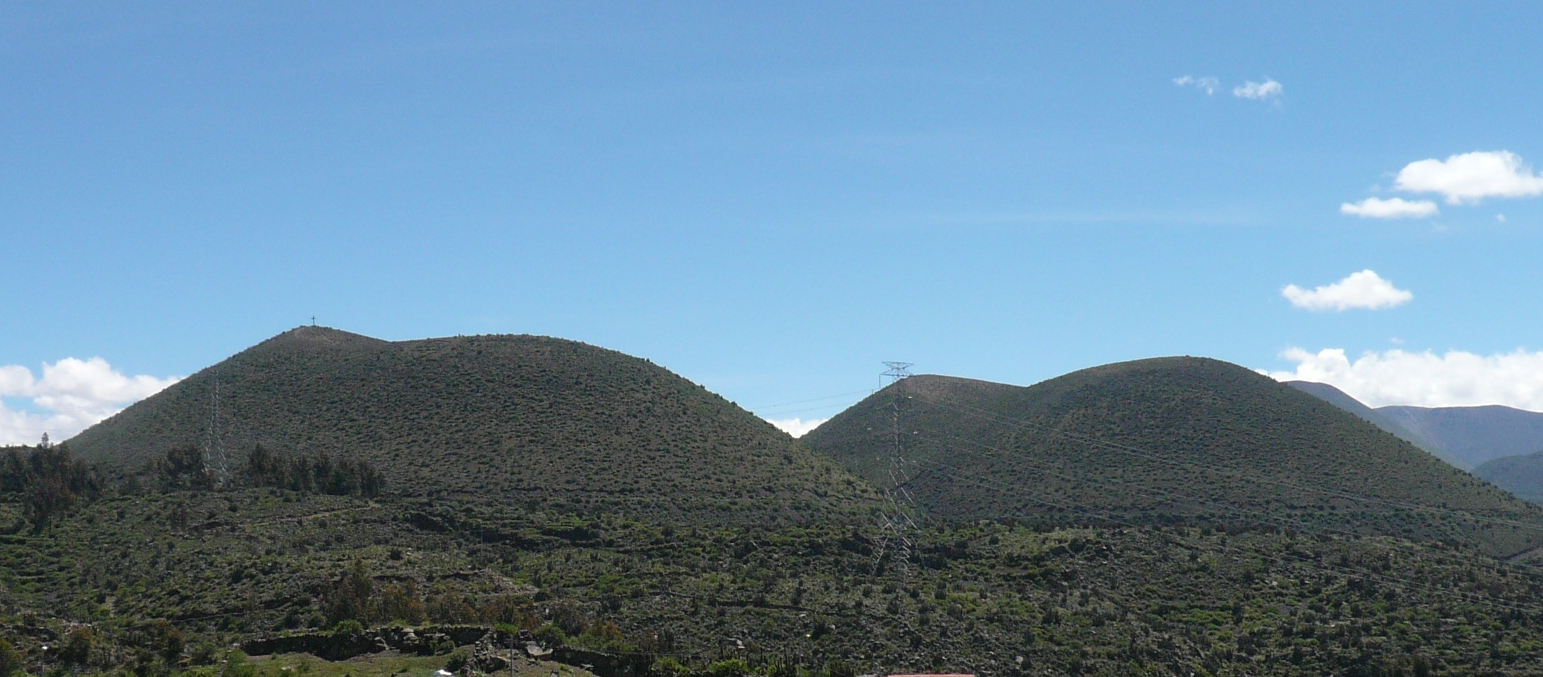
The first impression upon arriving at the Valley of the Volcanoes is one of spatial disorientation. The 32 identified cones do not form an ordered chain or a ridge of peaks: they are distributed irregularly across the lava plain, each with its own silhouette, its own slope angle, and its own character. Some are perfectly symmetrical, with smooth flanks and a defined summit; others are broken and eroded, their sides sunken by the centuries.
Pucamauras, the tallest cone, is both a visual landmark and a hiking destination. From its summit, the view encompasses the entire volcanic field: an irregular black sea of cones and lava with the Andean sky above, the snow-capped silhouette of Coropuna to the west, and the inhabited valley of Andagua at its foot. Reaching the summit from the base takes between 60 and 90 minutes of moderate ascent.
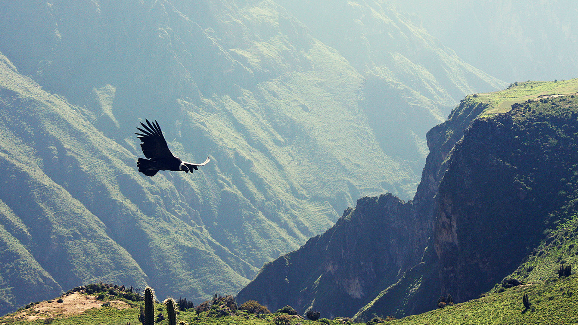
The flora that survives at this altitude and on this terrain has precise adaptations: giant prismatic cacti up to four meters tall grow in the crevices of the rock, vertical and solitary. Chachacoma and puma rosa — medicinal plants native to the puna zone — appear in sheltered micro-environments between lava formations where the soil retains some moisture. In the higher areas of the geopark, at 3,800 meters, the characteristic puna fauna includes Andean birds that nest in the grasslands bordering the volcanic field.
The silence of the valley has a particular texture. Basaltic lava absorbs sound, the wind in this part of the high plateau is rarely strong, and the absence of traffic or industrial activity means the only sounds are your own footsteps and the occasional flight of a bird above the cones.
Points of Interest in the Valley of the Volcanoes
The Twin Volcanoes: the two cones closest to the village of Andagua, just 3 kilometers from the main plaza. They are the first destination upon arrival: their similar height and near-symmetrical shapes make them the visual symbol of the valley. At dawn, with the raking light falling across the lava, the shadows they cast extend in dramatic shapes across the dark plain.
Pucamauras: at 350 meters above the valley floor, it is the tallest cone and the most challenging for hikers. The trail to its summit requires no technical equipment, but good physical fitness and prior acclimatization at 3,600 meters are essential. The reward is an aerial perspective of the entire volcanic field that no photograph can fully capture.
The Andagua Underground River: in the northern sector of the valley, you can observe the point where the Andagua River disappears beneath the lava. The contrast between moving water and the solid rock that swallows it is one of the most memorable moments of the visit — a geological metaphor for what makes this place unique.
Andagua Interpretation Center: located in the village, this space uses panels and scale models to explain the geological formation of the geopark, the history of the eruptions, and the life of the rural communities that have always lived among the volcanoes. It is the best starting point before entering the volcanic field.
Mamacocha Lagoon: located at the end where the underground river resurfaces, this high-altitude lagoon combines calm waters with a puna setting and the possibility of spotting Andean water birds. It is one of the quietest and least visited spots in the geopark.
Recommendations for Visiting the Valley of the Volcanoes
- The dry season from May to October offers the best conditions: clear skies, dry trails, and full visibility from the cone summits.
- The altitude of 3,600 meters above sea level can cause soroche (altitude sickness). If arriving directly from Arequipa (2,335 m), allow at least half a day to acclimatize in the village before attempting any ascent.
- Nights in Andagua are cold year-round, with temperatures that can drop below 5°C even in summer. Bring layered warm clothing regardless of the time of year.
- To photograph the volcanic cones with the best contrast, the hours around sunrise and sunset are far superior to midday, when vertical light flattens the lava textures and reduces the sense of depth.
- The Pucamauras trail requires trekking shoes with thick soles, at least 1.5 liters of water per person, and sunscreen. The irregular basalt ground can be treacherous with inappropriate footwear.
- Respect the agricultural boundaries of the communities. Part of the valley is working farmland: marked trails exist for good reason.
- In Andagua there are basic guesthouses, local restaurants, an ATM, and a police station. It is not necessary to bring everything from Arequipa, but carrying cash in soles is advisable.
How to Get to the Valley of the Volcanoes
Lima – Arequipa
Flight — approximately 1 hour 30 minutes. There are daily flights from Jorge Chávez International Airport to Arequipa’s Alfredo Rodríguez Ballón Airport. Airlines such as LATAM, Sky Airline, and Viva Air operate this route with multiple daily frequencies.
Intercity bus — between 16 and 18 hours. Companies such as Cruz del Sur, Oltursa, and Flores Hermanos offer overnight service, allowing you to take advantage of the following day in Arequipa before continuing to Andagua.
Arequipa – Andagua
Public bus — 312 km by paved road, approximately 8 hours. Service departs from the Arequipa bus terminal with regular frequency. Taking the overnight bus is recommended to arrive in Andagua in the morning and make the most of a full day in the valley.
Andagua – Valley of the Volcanoes
On foot from Andagua’s plaza — 3 km, 30 minutes to the Twin Volcanoes. The trail is signposted.
For more distant areas such as Pucamauras, the lagoons, or the northern sector of the geopark, hiring a local guide or arriving by private vehicle from Andagua is recommended.
Frequently Asked Questions about the Valley of the Volcanoes
How much time is needed to visit the Valley of the Volcanoes?
A full day is enough to explore the Twin Volcanoes, the Interpretation Center, and the underground river sector. To climb Pucamauras and visit Chachas or Mamacocha lagoons, at least two days in Andagua are needed. A third day allows for a relaxed exploration of the neighboring villages of Ayo and Chachas, which are also part of the geopark and have their own distinctive landscape character.
Can the Valley of the Volcanoes be visited year-round?
Yes, access is possible all twelve months. However, between November and April, rains can affect dirt roads inside the valley and may, on occasion, complicate the bus journey from Arequipa due to landslides. The dry season, from May to October, guarantees the best road conditions, skies, and visibility from the cone summits.
How much does entry to the Valley of the Volcanoes cost?
Access to the valley and its trails is free of charge. There is no fee to visit the volcanic cones or the lava field. The Andagua Interpretation Center may charge a small fee that varies depending on current municipal management; the best approach is to ask directly when you arrive in the village.
How difficult is it to get to the Valley of the Volcanoes from Arequipa?
The bus journey from Arequipa is long — around 8 hours — but not complicated: the road is paved and does not require four-wheel drive under normal conditions. The challenge lies in the altitude of the destination, 3,600 meters above sea level, which can affect travelers who have not had time to acclimatize. Arriving a day early before undertaking any strenuous ascents is the most effective measure against altitude sickness.
Are guides available in Andagua?
The village of Andagua has local guides who know the volcanic field in detail, including areas not marked on tourist maps. Hiring them not only enriches the visit with firsthand geological and cultural knowledge, but also contributes directly to the economy of the community that manages the geopark. Local guesthouses can usually arrange contact with certified guides.
Hours
- 8:00 AM – 5:00 PM
- Approximate schedule
Admission Price
- Free entry
- Approximate