Manu National Park in Cusco and Madre de Dios is a UNESCO Biosphere Reserve and World Heritage Site, recognized as one of the most biodiverse places on Earth.
Manu National Park is located in the valley of the Manu River, spanning the regions of Cusco and Madre de Dios. It is a protected natural area of exquisite biodiversity, recognized worldwide and shielded from human interference. The park not only protects an extraordinary flora of 2,000 to 5,000 plant species and a fauna of more than 2,000 species — including endangered animals such as the Andean mountain cat — but also safeguards invaluable cultural heritage expressed through the indigenous communities of this part of the Amazon, many of which have maintained their traditional ways of life across centuries. Some of these communities remain completely isolated from the outside world.
Manu National Park protects representative samples of the biodiversity and landscapes of the lowland jungle, the cloud forest belt (Ceja de Selva), and the Andean cordillera of southeastern Peru. Its existence also contributes to the recognition and protection of cultural diversity and the right to self-determination of the region’s indigenous peoples.
The park protects one of the most important areas on Earth, given its immense biodiversity. Its vast range traverses cold highland plateaus at over 4,000 meters above sea level; desolate forested mountains cut by small ravines and valleys; high-jungle cloud forests; and finally the great Amazonian lowlands. This magnificent and singular landscape encompasses a complex hydrology and ensures the existence of diverse ecosystems that have been virtually untouched by human intervention.
Flora and Fauna
Manu National Park hosts a staggering array of wildlife. Recorded species include approximately 160 mammal species, more than 1,000 bird species, around 140 amphibians, 50 snake species, 40 lizard species, 6 turtle species, 3 caiman species, and 210 fish species.
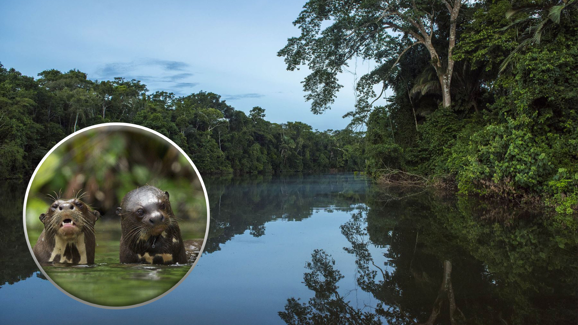
Among the large mammals, the most notable are the jaguar (otorongo), the black jaguar (tigre negro), the tapir (sachavaca), the white-lipped peccary (huangana), the collared peccary (sajino), the brocket deer, the giant river otter, the capybara (ronsoco), the howler monkey (coto mono), the black spider monkey (maquisapa negro), the woolly monkey (mono choro), and both the white-fronted and black-capped capuchin monkeys.
The insect diversity of the park is almost beyond comprehension — an estimated 30 million species. More than 1,300 butterfly species, 136 dragonfly species, at least 300 ant species (more than 40 found in a single tree), and over 650 beetle species have been recorded.
The park’s flora is equally impressive. At least 162 plant families, 1,191 genera, and 4,385 species have been identified, with up to 250 tree species found in a single hectare. The aguajal forests — dominated by aguaje and huasaí palms growing in almost permanently flooded terrain, especially on the right bank of the Manu River — are among the park’s most distinctive ecosystems.
Tourist Routes
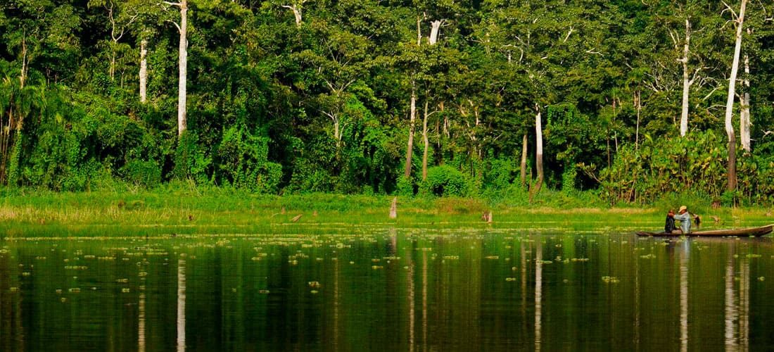
In the lower Manu River basin, visitors can experience the richness of the Amazonian lowlands. Five designated wildlife observation areas offer high concentrations of wildlife: Salvador, Otorongo, and Juárez (all oxbow lakes), as well as Pakitza and Limonal. These areas are served by trails and paths that offer stunning views of the tropical rainforest. Visitors should keep watch for oxbow lakes where rare species — such as giant otters and black caimans — are frequently seen. The forest along the Manu riverbanks harbors exceptional diversity of both flora and fauna. Clay licks (colpas) attract abundant wildlife, and aguajal forests concentrate typical fauna including large macaw flocks.
The Tres Cruces viewpoint, at the southern end of the park, offers spectacular sunrises at over 3,600 meters above the Amazonian plain. Due to an optical phenomenon — especially from May to August when the skies are clear — the sun appears to rise twice in a single dawn. The viewpoint also offers two opposite panoramas: the mountains to the south and the dense cloud forest to the north. From here, a marked hiking circuit of about 7 kilometers (3 hours) connects the Acjanaco observation station to the Pillahuata farm.
Local Communities
The tropical forests allow ecological and evolutionary processes to unfold with little or no human presence. Yet the region also possesses extraordinary cultural richness, represented by indigenous peoples at various stages of contact with the outside world, along with an archaeological heritage that has yet to be fully revealed.
Within the park’s borders lie the Territorial Reserve of the Kugapakori and Nahua ethnic groups, the Megantoni National Sanctuary, and the Amarakaeri Communal Reserve.
The communities of the Yora, Mashco-Piro, Matsiguenka, Harakmbut, Wachipaeri, and Yine people have inhabited these forests and rivers since ancient times. The communities of Tayakome and Yomibato are formally recognized within the park area, both located in the upper Manu River zone.
How to Get There
Lima to Puerto Maldonado: Flight — approximately 1 hour 40 minutes
Puerto Maldonado to Salvación (park gateway): Boat — approximately 1 day
Hours
- Depends on the operator
Admission Price
- Foreigners: S/30.00 soles
- Adults: S/15.00 soles
- Children: S/8.00 soles
- Locals: S/8.00 soles
- (Reference prices — verify before visiting)