The Chen Chen Geoglyphs are pre-Hispanic figures carved into the hillsides of Moquegua at 1,500 m, vestiges of the Tiwanaku and Huari cultures that once inhabited the region.
The Chen Chen Geoglyphs are located southwest of the city of Moquegua, across a series of small hills running east to west, at an altitude of between 1,474 and 1,534 meters above sea level. They constitute one of the most significant geoglyph complexes in southern Peru and a remarkable visual testament to the Tiwanaku culture that dominated this region between the 7th and 10th centuries AD.
Since 1985, researchers and experts have carried out ongoing investigation and conservation work at the site, analyzing human remains and conducting radiocarbon dating that indicates a substantial population in the Moquegua and Osmore valleys during that period.
The Tiwanaku Culture in Moquegua
The arrival of the Tiwanaku people on the southern plateau of Peru and Bolivia around 500 AD marked one of the most important moments in the pre-Columbian history of southern Peru. This civilization, which originated on the Bolivian altiplano, established colonies throughout the coastal valleys and Andean quebradas, including the Moquegua valley.
The first Tiwanaku settlers in the region established themselves at the site of Omo, and subsequently new settlements were founded, including Chen Chen, which flourished between 700 and 950 AD. The Chen Chen site became the largest Tiwanaku settlement outside the altiplano, with an estimated population of several thousand people engaged primarily in agriculture, the production of chicha de maíz, and trade.
The Geoglyphs: Description and Technique
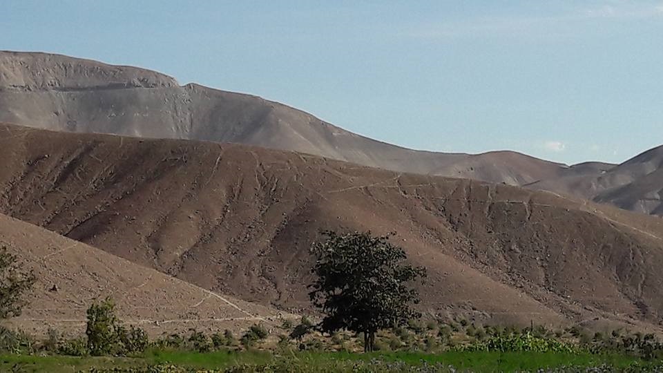
The Chen Chen geoglyphs are figures traced onto the slopes of the desert hills using a technique of superficial extraction or dissection: the upper layer of dark stones covering the terrain (approximately 10 cm deep) was removed, exposing the lighter sand beneath. The contrast between the dark surface and the lighter subsoil makes the figures visible.
The most abundant figures are camelid silhouettes (llamas or alpacas) measuring between 1 and 4 meters in length, most oriented facing east. Animals are depicted from the front, from the side, and from above, with varying degrees of detail and scale. Geometric figures and symbols of more complex interpretation are also present — these may have had religious or ritual significance.
To the east of the main group stands a camelid with all four legs visible, which is a rarity among this type of geoglyph, where side-profile representation is the norm.
What Were the Geoglyphs Used For?
Researcher Lautaro Núñez has proposed that these geoglyphs are linked to the economic activities that existed among the large population of the Andean settlement. The topographical pattern of the figures — pointing east and west — possibly indicates specific trade routes between the coastal valleys and the altiplano.
Other interpretations suggest a ritual and ceremonial purpose: camelids were sacred animals for Andean cultures, and their depiction on the hillsides may have formed part of rituals to ensure the reproduction of herds or to invoke the protection of the Apus (mountain spirits).
The orientation of the figures facing east — toward the rising sun — also carries religious connotations related to solar worship, which was fundamental to Tiwanaku civilization.
How to Reach and View the Geoglyphs
The best way to appreciate the Chen Chen geoglyphs is to arrive early in the morning or at sunset, when the raking light of the sun creates shadows that make the outlines more visible and easier to identify from the ground. During the middle hours of the day, direct light tends to flatten the contrasts and reduce visibility.
To reach the site from central Moquegua, take Calle Tacna heading southwest, pass the Mirador Park, continue through Villa Francia, cross the Binational Highway, and follow the road to Toquepala until you reach the area where the geoglyphs are located.
Threats and Conservation
Like many of Peru’s geoglyphs, those at Chen Chen have suffered damage from urban expansion, vehicle traffic, and unregulated human activity. The construction of the Moquegua-Desaguadero Binational Highway in past decades damaged some groups of figures.
Researchers and local authorities are working to protect the site and raise awareness of its value among the local population. Responsible visiting — not approaching the figures too closely, not disturbing the markings, and not leaving litter — is essential for the preservation of this heritage.
How to Get There
Lima to Ilo: Flight — approximately 1 hour 40 minutes
Ilo to Chen Chen Geoglyphs: Bus — approximately 1 hour 20 minutes
Hours
- Monday to Sunday: 7:00 AM to 5:00 PM
Admission Price
- Free access